
Ibarra topographic map
Click on the map to display elevation.
About this map
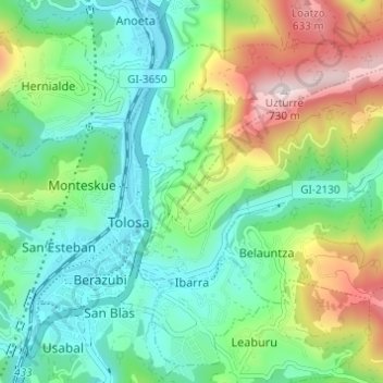
Name: Ibarra topographic map, elevation, terrain.
Average elevation: 259 m
Minimum elevation: 59 m
Maximum elevation: 712 m
Other topographic maps
Click on a map to view its topography, its elevation and its terrain.
Arrutiegia
Spain > Autonomous Community of the Basque Country > Urola-Kosta > Aia
Average elevation: 223 m
Donostia / San Sebastián
Spain > Autonomous Community of the Basque Country > Donostialdea > Donostia / San Sebastián
Average elevation: 134 m