Geolocate

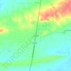
Wooster topographic map

Click on the map to display elevation.

About this map

Name: Wooster topographic map, elevation, terrain.

Location: Wooster, Faulkner County, Arkansas, 72181, United States (35.17875 -92.46719 35.21546 -92.43759)

Average elevation: 101 m

Minimum elevation: 82 m

Maximum elevation: 149 m

Other topographic maps

Click on a map to view its topography, its elevation and its terrain.

Wooster

United States > Arkansas > Faulkner County > Wooster

Average elevation: 101 m

Cato

United States > Arkansas > Faulkner County

Average elevation: 106 m

Gear up for your next adventure:

⛺Backpacking Tent - Lightweight tent for long-distance hiking trips
🥾All-Terrain Hiking Boots - Versatile boots for varied hiking conditions
🦶Hiking Shoe Insoles - Added support for high arches and long days on feet
🧴Insect Repellent - Protect yourself from bugs during outdoor adventures
💧Filtered Water Bottle - Safe drinking water on the go

As an Amazon Associate, this site earns from qualifying purchases at no extra cost to you.