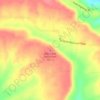
Beebe topographic map
Click on the map to display elevation.
Beebe
Beebe made international news in early January 2011 following the death of more than 3,000 red-winged blackbirds and European starlings over the community. Arkansas state wildlife authorities first received reports on December 31, 2010, shortly before midnight. Further investigation revealed the birds fell over a one-mile (1.6 km) area of Beebe, with no other dead birds found outside that concentrated zone. The birds showed signs of physical trauma, leading one ornithologist with the Arkansas Game and Fish Commission to speculate the blackbirds might have been killed by lightning, high-altitude hail or possibly even fireworks. The birds were sent to laboratories in Georgia and Wisconsin for necropsies and to determine the cause of death. On January 5, the Arkansas Game and Fish Commission confirmed that the incident was caused by a resident setting off professional-grade fireworks, startling the birds into a panic flight.
About this map

Name: Beebe topographic map, elevation, terrain.
Location: Beebe, White County, Arkansas, 72012, United States (35.04996 -91.96292 35.09525 -91.85520)
Average elevation: 71 m
Minimum elevation: 55 m
Maximum elevation: 121 m
Other topographic maps
Click on a map to view its topography, its elevation and its terrain.