
Blakesley topographic map
Click on the map to display elevation.
About this map
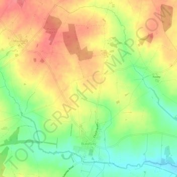
Name: Blakesley topographic map, elevation, terrain.
Location: Blakesley, West Northamptonshire, England, United Kingdom (52.14109 -1.10966 52.17465 -1.05121)
Average elevation: 141 m
Minimum elevation: 102 m
Maximum elevation: 175 m
Other topographic maps
Click on a map to view its topography, its elevation and its terrain.
Lower Thorpe
United Kingdom > England > West Northamptonshire > Thorpe Mandeville
Average elevation: 154 m
Ravensthorpe Reservoir
United Kingdom > England > West Northamptonshire > Coton
Average elevation: 131 m