
Saint-Augustin-de-Woburn topographic map
Interactive map
Click on the map to display elevation.
Saint-Augustin-de-Woburn
It is 5km from Canada–United States border and the Coburn Gore-Woburn Border Crossing. Mount Gosford lies entirely within the parish, making Woburn one of the highest towns in Quebec, at an altitude of 1,193 metres (3,914 ft).
About this map
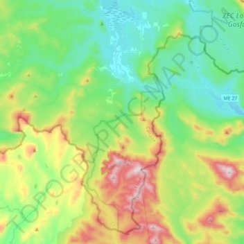
Name: Saint-Augustin-de-Woburn topographic map, elevation, terrain.
Location: Saint-Augustin-de-Woburn, Le Granit, Quebec, G0Y 1R0, Canada (45.22914 -70.97110 45.45417 -70.62127)
Average elevation: 620 m
Minimum elevation: 386 m
Maximum elevation: 1,190 m
Le Granit trails, hiking, mountain biking, running and outdoor activities
Other topographic maps
Click on a map to view its topography, its elevation and its terrain.