
Puslinch topographic map
Interactive map
Click on the map to display elevation.
About this map
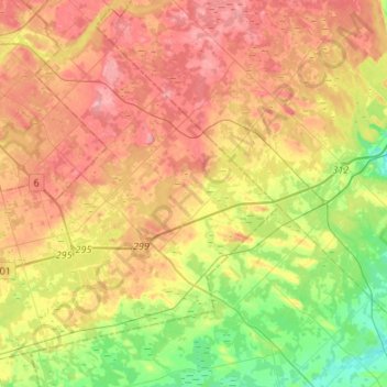
Name: Puslinch topographic map, elevation, terrain.
Location: Puslinch, Wellington County, Ontario, Canada (43.38696 -80.30284 43.56768 -80.03385)
Average elevation: 317 m
Minimum elevation: 254 m
Maximum elevation: 379 m
Wellington County trails, hiking, mountain biking, running and outdoor activities
Other topographic maps
Click on a map to view its topography, its elevation and its terrain.
Belwood Lake Boat Launch
Canada > Ontario > Wellington County > Centre Wellington
Average elevation: 443 m