
Ashfield–Colborne–Wawanosh topographic map
Interactive map
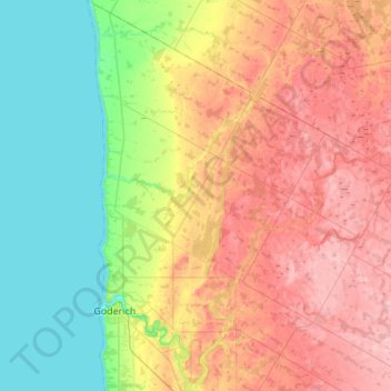
Click on the map to display elevation.
About this map
Name: Ashfield–Colborne–Wawanosh topographic map, elevation, terrain.
Location: Ashfield–Colborne–Wawanosh, Huron County, Ontario, Canada (43.66181 -81.74962 44.05562 -81.41728)
Average elevation: 252 m
Minimum elevation: 174 m
Maximum elevation: 363 m
Huron County trails, hiking, mountain biking, running and outdoor activities
Other topographic maps
Click on a map to view its topography, its elevation and its terrain.