
Town of Digby topographic map
Interactive map
Click on the map to display elevation.
About this map
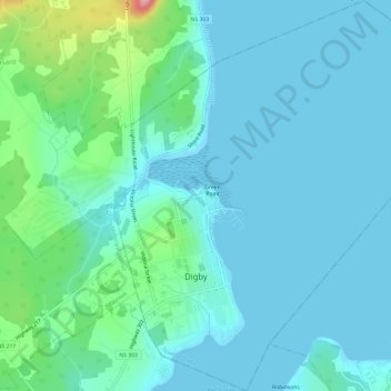
Name: Town of Digby topographic map, elevation, terrain.
Location: Town of Digby, Digby County, Nova Scotia, B0V 1A0, Canada (44.60691 -65.77113 44.64945 -65.71494)
Average elevation: 25 m
Minimum elevation: -1 m
Maximum elevation: 150 m
Digby County trails, hiking, mountain biking, running and outdoor activities
Other topographic maps
Click on a map to view its topography, its elevation and its terrain.