Geolocate

Umred topographic maps

Click on a map to view its topography, its elevation and its terrain.

Umred

India > Maharashtra > Umred

Umred is located at 20° 51' 14N and 17° 19' 29E, at an elevation of 290 meters above sea level. It's STD code is 07116.

Average elevation: 281 m
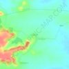
Kalandri

India > Maharashtra > Umred

Average elevation: 297 m

Amboli

India > Maharashtra > Umred

Average elevation: 272 m

Gear up for your next adventure:

🧼Biodegradable Camp Soap - Environmentally friendly cleaning for gear and body
🥾Trail Hiking Shoes - Durable shoes designed for rugged trails
🛌Insulated Sleeping Pad - Critical thermal barrier between you and the cold ground
🥾Trail Hiking Boots - Supportive boots for rough trails
⛺Bushcraft Tarp - Versatile emergency shelter or gear protection

As an Amazon Associate, this site earns from qualifying purchases at no extra cost to you.