Geolocate

Panaun topographic maps

Click on a map to view its topography, its elevation and its terrain.
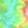
Rauta

India > Uttarakhand > Thailisain > Panaun

Average elevation: 1,718 m

Gear up for your next adventure:

🕯️Camping Lantern - Illuminates your entire campsite with high-efficiency LEDs
🧭GPS Tracker - Track your location in remote areas safely
🧣Merino Neck Gaiter - Protects against wind, sun, and cold at high altitudes
💧Hydration Bladder - Hands-free hydration solution for long treks
⛺Lightweight Camping Tent - Portable shelter optimized for Canadian backcountry camping

As an Amazon Associate, this site earns from qualifying purchases at no extra cost to you.