Geolocate

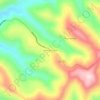
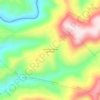
Seara topographic maps

Click on a map to view its topography, its elevation and its terrain.

Linha São Paulo

Brasil > Santa Catarina > Seara

Average elevation: 630 m

Linha Forquilinha

Brasil > Santa Catarina > Seara

Average elevation: 636 m

Gear up for your next adventure:

🔦LED Headtorch - Bright and durable light for night activities
🥾Trail Hiking Shoes - Durable shoes designed for rugged trails
🧳Compression Sacks - Maximize space in your backpack by shrinking gear
🧥Ultralight Puffy Jacket - Maximum warmth that packs down to the size of an orange
🏕️Camping Hammock - Integrated protection for sleeping between trees

As an Amazon Associate, this site earns from qualifying purchases at no extra cost to you.