Geolocate

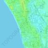
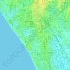
Kuta topographic maps

Click on a map to view its topography, its elevation and its terrain.

Legian

Indonesia > Bali > Badung > Kuta

Average elevation: 5 m

Seminyak

Indonesia > Bali > Badung > Kuta

Average elevation: 9 m

Kuta Beach

Indonesia > Bali > Badung > Kuta

Average elevation: 4 m

Gear up for your next adventure:

🗺️Topographic Maps - Detailed maps to explore trails, mountains, and wilderness areas
🥾Approach Shoes - Shoes designed for climbing approaches and rugged trails
🧥Softshell Hiking Jacket - The perfect balance of wind protection and breathability
🧢Hiking Sun Hat - Wide-brimmed protection for exposed mountain ridges
🩹Compact First Aid Kit - Pre-packed essentials for common trail injuries

As an Amazon Associate, this site earns from qualifying purchases at no extra cost to you.