Geolocate

Paraná topographic maps

Click on a map to view its topography, its elevation and its terrain.

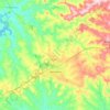
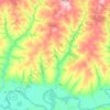
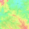
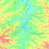
Campo Bonito

Brazil > Paraná

Average elevation: 589 m

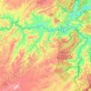
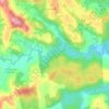
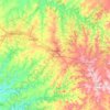
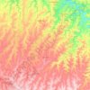
Lajeado

Brazil > Paraná > Antonina

Average elevation: 98 m

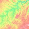
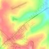
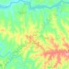
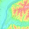
Colônia São João

Brazil > Paraná > Foz do Iguaçu

Average elevation: 200 m

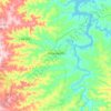
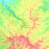
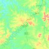
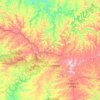
Tijucas do Sul

Brazil > Paraná

Average elevation: 911 m

Atalaia

Brazil > Paraná

Average elevation: 444 m

Vista Alegre

Brazil > Paraná > Toledo

Average elevation: 551 m

Iguazu Falls

Brazil > Paraná > Foz do Iguaçu

Average elevation: 185 m

Ubiratã

Brazil > Paraná

Average elevation: 429 m

C014

Brazil > Paraná > Palotina

Average elevation: 308 m

745

Brazil > Paraná > Palotina

Average elevation: 332 m

Country

Brazil > Paraná > Cascavel

Average elevation: 739 m

Bom Sucesso do Sul

Brazil > Paraná

Average elevation: 629 m

Ortigueira

Brazil > Paraná

Average elevation: 740 m

Apucarana

Brazil > Paraná

Apucarana is a municipality in the state of Paraná in Brazil. The municipality covers 548 square kilometres (212 sq mi) at an elevation of 840 metres (2,760 ft) above mean sea level. Its 2020 population was estimated as 136,234.

Average elevation: 662 m

Honey Island

Brazil > Paraná > Paranaguá

Average elevation: 3 m

Itaipu Dam

Brazil > Paraná > Foz do Iguaçu

325 metres (1,066 ft), entire dam including the 100 metres (330 ft) high Power Line 4 Pylons atop the Barrage 260 metres (850 ft), dam + the foundation inside water until the river floor 247 metres (810 ft), 196 metres (643 ft) high of roof reinforcement concrete dam + Cranes atop the Barrage 225 metres (738…

Average elevation: 192 m

Uraí

Brazil > Paraná

Average elevation: 452 m

Pato Branco

Brazil > Paraná

Average elevation: 688 m

Telêmaco Borba

Brazil > Paraná

Average elevation: 765 m

Rio Bonito do Iguaçu

Brazil > Paraná

Average elevation: 636 m

Curitiba

Brazil > Paraná > Região Metropolitana de Curitiba

The city covers 432.17 km2 (166.86 sq mi) on the First Plateau of Paraná. Curitiba has a topography of smooth, rounded hills, giving it a relatively regular shape. The city has an average altitude of 934.6 m (3,066 ft) above sea level. The highest point is to the north at 1,021 m (3,350 ft), and with lower…

Average elevation: 931 m

Assaí

Brazil > Paraná

Average elevation: 538 m

Campo Mourão

Brazil > Paraná

The Township belongs to the Paraná Basin, including the important river Rio Mourão, which crosses the city from south to north. The flow of the river, coupled with the topography of its valley, offers the greatest potential hydrodynamic city, explored with the construction of the Plant Mourão. Other major…

Average elevation: 612 m

Itaipu Dam

Brazil > Paraná > Foz do Iguaçu

325 metres (1,066 ft), entire dam including the four 100 metres (330 ft) high Power Line Pylons atop the Barrage 260 metres (850 ft), dam barrage + the foundation inside water until the slope river floor 247 metres (810 ft), 196 metres (643 ft) high of roof reinforcement concrete barrage dam + Cranes atop the…

Average elevation: 203 m

Arapoti

Brazil > Paraná

Average elevation: 756 m

Ivaiporã

Brazil > Paraná

Average elevation: 638 m

Castro

Brazil > Paraná

Average elevation: 960 m

Céu Azul

Brazil > Paraná

Average elevation: 420 m

Vitória

Brazil > Paraná > Guarapuava > Entre Rios

Average elevation: 1,117 m

Inácio Martins

Brazil > Paraná

Average elevation: 1,043 m

Santa Helena

Brazil > Paraná

Average elevation: 259 m

Iguazu River

Brazil > Paraná > Foz do Iguaçu > Setor 10450

Average elevation: 190 m

Foz do Iguaçu

Brazil > Paraná

The climate of the city is hot or warm throughout the year, due to the relatively low altitude (standing only 173 m, 567 ft (173 m), above sea level).

Average elevation: 228 m
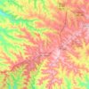
Santa Tereza do Oeste

Brazil > Paraná

Average elevation: 646 m

Mandaguari

Brazil > Paraná

Average elevation: 595 m

Mandaguaçu

Brazil > Paraná

Average elevation: 500 m

Morro das Encantadas

Brazil > Paraná > Paranaguá

Average elevation: 8 m

Rolândia

Brazil > Paraná

Average elevation: 635 m

Nova Esperança

Brazil > Paraná

Average elevation: 481 m

Pinhalão

Brazil > Paraná

Average elevation: 649 m

Lavrinhas

Brazil > Paraná > Guarapuava

Average elevation: 1,123 m

São Pedro do Iguaçu

Brazil > Paraná

Average elevation: 503 m

Candói

Brazil > Paraná

Average elevation: 819 m

Carlópolis

Brazil > Paraná

Average elevation: 541 m

Loanda

Brazil > Paraná

Average elevation: 365 m

Guarapuava

Brazil > Paraná

Guarapuava is located at 25°23'36" S and 51°27'19" W. The region is known as the centre of the state of Paraná, in the third plateau, also called the Plateau of Guarapuava. Discovered by the Portuguese in 1770, and founded in 1810, the city's name derives from tupi guarani, meaning place of Maned wolves…

Average elevation: 1,001 m
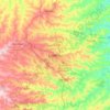
Londrina

Brazil > Paraná > Londrina

Average elevation: 516 m

Mamborê

Brazil > Paraná

Average elevation: 667 m

Palotina

Brazil > Paraná

Average elevation: 322 m

Medianeira

Brazil > Paraná

Average elevation: 375 m

Coronel Vivida

Brazil > Paraná

Average elevation: 708 m

Cerro Azul

Brazil > Paraná

Average elevation: 669 m

São Sebastião da Amoreira

Brazil > Paraná

Average elevation: 619 m

Sertanópolis

Brazil > Paraná

Average elevation: 421 m

Santa Isabel do Ivaí

Brazil > Paraná

Average elevation: 322 m

Sarandi

Brazil > Paraná

Average elevation: 518 m

Antonina

Brazil > Paraná

Average elevation: 367 m

Engenheiro Beltrão

Brazil > Paraná

Engenheiro Beltrão is in the state of Paraná, Brazil. It has an area of 467.470 square kilometres (180.491 sq mi) as of 2018. The elevation above sea level is about 520 metres (1,710 ft). The municipality is on the left bank of the Ivaí River, in the central region of Paraná, to the northwest. It 55…

Average elevation: 388 m

Bituruna

Brazil > Paraná

Average elevation: 976 m

Rio Grande

Brazil > Paraná > Pinhão

The Rio Grande rises in high mountains and flows for much of its length at high elevation; the valley floor at Albuquerque is 5,312 feet (1,619 m), and El Paso 3,762 feet (1,147 m) above sea level. In New Mexico, the river flows through the Rio Grande rift from one sediment-filled basin to another, cutting…

Average elevation: 996 m

Morretes

Brazil > Paraná

Average elevation: 470 m

Rio Bonito

Brazil > Paraná > Francisco Beltrão

Average elevation: 690 m

terminal

Brazil > Paraná > Andirá

Average elevation: 460 m

Imbaú

Brazil > Paraná

Average elevation: 810 m

Santo Antônio do Sudoeste

Brazil > Paraná

Average elevation: 559 m

Curiúva

Brazil > Paraná

Average elevation: 717 m

Marialva

Brazil > Paraná

Average elevation: 527 m

Marmeleiro

Brazil > Paraná

Average elevation: 748 m

Cruz Machado

Brazil > Paraná

Average elevation: 1,007 m

Cianorte

Brazil > Paraná

Average elevation: 475 m

Barbosa Ferraz

Brazil > Paraná

Average elevation: 430 m

Andirá

Brazil > Paraná

Average elevation: 427 m

Guaira

Brazil > Paraná

Guaíra (Brazilian Portuguese pronunciation: [ɡwaˈiɾɐ]) is a municipality in the state of Paraná in the Southern Region of Brazil. The population is 33,310 (2020 est.) in an area of 560 km2. The elevation is 517 m. This place name comes from the Tupi language and means "place difficult to access". It…

Average elevation: 281 m
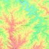
Dois Vizinhos

Brazil > Paraná

Dois Vizinhos ("Two Neighbours" in English) gained its municipality on November 28, 1961. It is a Brazilian municipality in the southwestern state of Paraná, situated in the southwestern mesoregion of the state and in the microregion of Francisco Beltrão. It is at an average altitude of 509 meters in…

Average elevation: 512 m
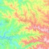
Marechal Candido Rondon

Brazil > Paraná

Average elevation: 349 m

Nova Londrina

Brazil > Paraná

Average elevation: 354 m

Santo Antônio da Platina

Brazil > Paraná

Average elevation: 516 m

Wenceslau Braz

Brazil > Paraná

Average elevation: 658 m

Flor da Serra do Sul

Brazil > Paraná

Average elevation: 739 m

Uniflor

Brazil > Paraná

Average elevation: 468 m

Astorga

Brazil > Paraná

Average elevation: 561 m

Tibagi

Brazil > Paraná

Average elevation: 897 m

Jataizinho

Brazil > Paraná

Average elevation: 426 m

Corbélia

Brazil > Paraná

Average elevation: 565 m

Querência do Norte

Brazil > Paraná

Average elevation: 281 m

Braganey

Brazil > Paraná

Average elevation: 543 m

Nova Laranjeiras

Brazil > Paraná

Average elevation: 703 m

About this place

 •  •  •  •  •  •  •  •  •  •  •  •  •  •  •  •  •

Gear up for your next adventure:

🧦Hiking Socks - Moisture-wicking and comfortable socks for long hikes
🔋Solar Power Bank - Keep your GPS and devices charged during long outdoor trips
🥾Waterproof Trail Shoes - Shoes designed to handle wet terrain
🎒Hiking Backpack - Lightweight and ergonomic backpacks for day hikes or multi-day treks
🐕Hiking Dog Pack - Let your canine companion carry their own water and food

As an Amazon Associate, this site earns from qualifying purchases at no extra cost to you.