Geolocate

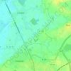
Lorgies topographic maps

Click on a map to view its topography, its elevation and its terrain.

Le Bourg

France > Hauts-de-France > Pas-de-Calais > Lorgies

Average elevation: 24 m

Gear up for your next adventure:

🥾Hiking Gaiters - Protect legs and shoes from mud, snow, and debris
🚲Handlebar Phone Mount - View topographic-map.com live while cycling
🛶Waterproof Dry Bags - Keep electronics and clothes dry during river crossings
👟Leg Gaiters - Keep debris, mud, and snow out of your boots
🧤Insulated Winter Gloves - Heavy-duty protection for sub-zero Canadian adventures

As an Amazon Associate, this site earns from qualifying purchases at no extra cost to you.