Geolocate

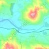
Freha topographic maps

Click on a map to view its topography, its elevation and its terrain.

Tamda

Algeria > Tizi Ouzou > Azazga District > Freha

Average elevation: 139 m

Gear up for your next adventure:

🧦Crew Hiking Socks - Comfortable socks for long-distance hikes
🧼Biodegradable Camp Soap - Environmentally friendly cleaning for gear and body
🛶Canoe Life Vest - Safety vest for water sports
🚲Bike Repair Kit - Essential tools for on-trail mechanical issues
🧥Waterproof Jacket - Lightweight rain jackets for hiking and outdoor activities

As an Amazon Associate, this site earns from qualifying purchases at no extra cost to you.