Geolocate

Oswego topographic maps

Click on a map to view its topography, its elevation and its terrain.
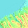
Oswego

United States > New York > Oswego

Oswego is located on the southeastern shore of Lake Ontario at the mouth of the Oswego River, approximately 35 miles north of Syracuse and 69 miles east of Rochester. The elevation is 298 feet above sea level. The nearest city is Fulton, located south of Oswego and north of Syracuse.

Average elevation: 91 m

Gear up for your next adventure:

🧢Hiking Sun Hat - Wide-brimmed protection for exposed mountain ridges
👖Convertible Hiking Pants - Zip-off legs to adapt to changing weather conditions
🛏️Sleeping Bag - Warm and compact sleeping bags for outdoor camping
🛰️Satellite Messenger - Emergency communication for areas with no cell service
🧳Compression Sacks - Maximize space in your backpack by shrinking gear

As an Amazon Associate, this site earns from qualifying purchases at no extra cost to you.