Geolocate

Santa Rosa topographic maps

Click on a map to view its topography, its elevation and its terrain.

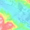
Melita

United States > California > Sonoma County > Santa Rosa

Average elevation: 148 m

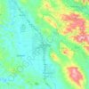
Oakmont

United States > California > Sonoma County > Santa Rosa

Average elevation: 215 m

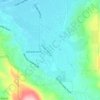
Bellevue

United States > California > Sonoma County > Santa Rosa

Average elevation: 47 m

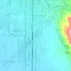
Monroe

United States > California > Sonoma County > Santa Rosa

Average elevation: 38 m

Gear up for your next adventure:

🚲Bike Repair Kit - Essential tools for on-trail mechanical issues
🥾Trail Running Boots - Durable shoes designed for trail running
🗺️Topographic Maps - Detailed maps to explore trails, mountains, and wilderness areas
🥫Freeze-Dried Meals - Lightweight, high-calorie nutrition for multi-day treks
⛺Tent Footprint - Protect tent floor and increase durability

As an Amazon Associate, this site earns from qualifying purchases at no extra cost to you.