Geolocate

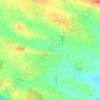
Langton topographic maps

Click on a map to view its topography, its elevation and its terrain.

Langton

United Kingdom > England > County Durham > Langton

Average elevation: 105 m

Gear up for your next adventure:

🧥Ultralight Puffy Jacket - Maximum warmth that packs down to the size of an orange
🥾Hiking Leggings - Comfortable leggings for outdoor activities
🐕Hiking Dog Pack - Let your canine companion carry their own water and food
🎒Backpack Rain Cover - External shield to keep your entire pack dry
🧭Orienteering Kit - Tools for map reading and navigation in the wild

As an Amazon Associate, this site earns from qualifying purchases at no extra cost to you.