Geolocate

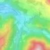
Ax-les-Thermes topographic maps

Click on a map to view its topography, its elevation and its terrain.

Plateau de Bonascre

France > Occitanie > Ariège > Ax-les-Thermes

Average elevation: 1,228 m

Petches

France > Occitanie > Ariège > Ax-les-Thermes

Average elevation: 1,104 m

2e Bazerque

France > Occitanie > Ariège > Ax-les-Thermes

Average elevation: 1,102 m

1ere Bazerque

France > Occitanie > Ariège > Ax-les-Thermes

Average elevation: 1,045 m

Rocher de la Vierge

France > Occitanie > Ariège > Ax-les-Thermes > Rufat

Average elevation: 906 m

Bonascre

France > Occitanie > Ariège > Ax-les-Thermes > 3e Bazerque

Average elevation: 1,120 m

Rufat

France > Occitanie > Ariège > Ax-les-Thermes

Average elevation: 994 m

About this place

 •

Gear up for your next adventure:

🚲Heavy Duty Bike Lock - Secure your bike at the trailhead or during stops
🧥Softshell Jacket - Windproof and breathable jacket for hiking
🥾Trail Hiking Shoes - Durable shoes designed for rugged trails
🧢Sun Hat - Wide-brim hat for sun protection
🥾Hiking Leggings - Comfortable leggings for outdoor activities

As an Amazon Associate, this site earns from qualifying purchases at no extra cost to you.