Geolocate

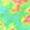
Blaisy topographic maps

Click on a map to view its topography, its elevation and its terrain.

Blaisy

France > Bourgogne-Franche-Comté > Nièvre > Chaumard > Blaisy

Average elevation: 374 m

Gear up for your next adventure:

🥾Hiking Boots - Sturdy boots providing ankle support and traction on rugged trails
🚲Handlebar Phone Mount - View topographic-map.com live while cycling
🧤Thermal Hiking Gloves - Grip-enhanced gloves for cold-weather altitude trekking
🏕️Camping Hammock - Integrated protection for sleeping between trees
🎒Hiking Daypack - Lightweight and durable backpacks for day trips and excursions

As an Amazon Associate, this site earns from qualifying purchases at no extra cost to you.