Geolocate

Steige topographic maps

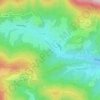
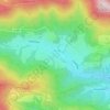
Click on a map to view its topography, its elevation and its terrain.

Champs des Fontaines

France > Grand Est > Bas-Rhin > Steige

Average elevation: 472 m

Champs des Fontaines

France > Grand Est > Bas-Rhin > Steige

Average elevation: 503 m

Gear up for your next adventure:

🎒Fully Waterproof Backpack - Total protection for photography gear and electronics
🥾Waterproof Trail Shoes - Shoes designed to handle wet terrain
🧦Outdoor Socks - Durable socks designed for hiking and outdoor sports
🗺️Topographic Maps - Detailed maps to explore trails, mountains, and wilderness areas
🦌Outdoor Trail Camera - Monitor wildlife activity near your favorite spots

As an Amazon Associate, this site earns from qualifying purchases at no extra cost to you.