Geolocate

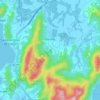
Ratones topographic maps

Click on a map to view its topography, its elevation and its terrain.

Ratones

Brasil > Santa Catarina > Florianópolis > Ratones

Average elevation: 77 m

Gear up for your next adventure:

🗺️Topographic Maps - Detailed maps to explore trails, mountains, and wilderness areas
🧴Waterproofing Spray - Restore the DWR coating on jackets and tents
🦶Anti-Blister Balm - Prevents friction and hotspots during long ascents
🥾Hiking Shorts - Breathable shorts suitable for summer hikes
🥾Trekking Boots - Durable boots for long-distance trekking

As an Amazon Associate, this site earns from qualifying purchases at no extra cost to you.