Geolocate

Argonne topographic maps

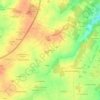
Click on a map to view its topography, its elevation and its terrain.

Argonne

France > Pays de la Loire > Chemillé-en-Anjou > Argonne

Average elevation: 84 m

Gear up for your next adventure:

🗺️Topographic Maps - Detailed maps to explore trails, mountains, and wilderness areas
🧼Biodegradable Camp Soap - Environmentally friendly cleaning for gear and body
🌬️Windproof Camp Stove - Efficient cooking even on exposed mountain peaks
⛺Backpacking Tent - Lightweight tent for long-distance hiking trips
🔋Emergency Crank Radio - Weather alerts and power without needing batteries

As an Amazon Associate, this site earns from qualifying purchases at no extra cost to you.