Geolocate

Corancy topographic maps

Click on a map to view its topography, its elevation and its terrain.

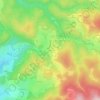
Lorien

France > Bourgogne-Franche-Comté > Nièvre > Corancy

Average elevation: 524 m

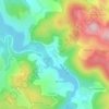
Les Vouas

France > Bourgogne-Franche-Comté > Nièvre > Corancy

Average elevation: 408 m

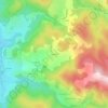
Chagnon

France > Bourgogne-Franche-Comté > Nièvre > Corancy

Average elevation: 502 m

Gear up for your next adventure:

💡LED Headlamp - Hands-free illumination for night hiking and camping
🕶️Polarized Sunglasses - Protect your eyes with durable polarized lenses
🥾Light Hiking Boots - Lightweight and comfortable boots for day hikes
🛶Waterproof Dry Bags - Keep electronics and clothes dry during river crossings
🔭Compact Monocular - One-handed bird watching and trail spotting

As an Amazon Associate, this site earns from qualifying purchases at no extra cost to you.