Geolocate

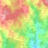
Leira topographic maps

Click on a map to view its topography, its elevation and its terrain.

Menlle

España > Galicia > Ordes > Leira

Average elevation: 353 m

Gear up for your next adventure:

🥾Trekking Poles - Adjustable trekking poles to reduce knee stress and improve stability
🧶550 Survival Paracord - Versatile utility cord for emergency repairs and rigging
🔭Outdoor Binoculars - Lightweight binoculars for birdwatching and hiking
🔪Outdoor Multitool - Versatile tool for repairs and food prep in the wild
🎒Hiking Daypack - Lightweight and durable backpacks for day trips and excursions

As an Amazon Associate, this site earns from qualifying purchases at no extra cost to you.