Geolocate

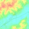
Spring Hill topographic maps

Click on a map to view its topography, its elevation and its terrain.

Spring Hill

United States > Iowa > Warren County > Spring Hill

Average elevation: 265 m

Gear up for your next adventure:

🔨Vehicle Emergency Tool - Safety tool for remote road trips to trailheads
👟Trail Running Shoes - Agile footwear for fast-paced topographic exploration
🥾Hiking Shoes - Durable and comfortable shoes for trail hiking
🎒Hiking Daypack - Lightweight and durable backpacks for day trips and excursions
🗺️Topographic Maps - Detailed maps to explore trails, mountains, and wilderness areas

As an Amazon Associate, this site earns from qualifying purchases at no extra cost to you.