Geolocate

Erlangen topographic maps

Click on a map to view its topography, its elevation and its terrain.

Erlangen

Germany > Bavaria > Erlangen

In 1435 the church, which had been the daughter church of St. Martin in Forchheim up until this point, was elevated to its own parish. The main task of the Erlangen priest was the pastoral care in the city of Erlangen and the St. Martin's Chapel on the Martinsbühl, which was now named for the first time.…

Average elevation: 331 m
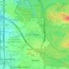
Tennenlohe

Germany > Bavaria > Erlangen

Average elevation: 301 m

Gear up for your next adventure:

🥾Mountain Hiking Boots - High-traction boots for rocky terrain
🥾Waterproof Hiking Shoes - Durable shoes for wet and rugged trails
🩹Compact First Aid Kit - Pre-packed essentials for common trail injuries
🧭GPS Outdoor Watch - Smart watch for navigation and fitness tracking in nature
⛺Lightweight Camping Tent - Portable shelter optimized for Canadian backcountry camping

As an Amazon Associate, this site earns from qualifying purchases at no extra cost to you.