Geolocate

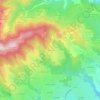
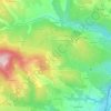
Cellieu topographic maps

Click on a map to view its topography, its elevation and its terrain.

Les Écheries

France > Auvergne-Rhône-Alpes > Loire > Cellieu

Average elevation: 633 m

Peyrieux

France > Auvergne-Rhône-Alpes > Loire > Cellieu

Average elevation: 528 m

Croix Blanche

France > Auvergne-Rhône-Alpes > Loire > Cellieu > Les Ayats

Average elevation: 642 m

La Cognetière

France > Auvergne-Rhône-Alpes > Loire > Cellieu

Average elevation: 462 m

Salcigneux

France > Auvergne-Rhône-Alpes > Loire > Cellieu

Average elevation: 430 m

Les Heures

France > Auvergne-Rhône-Alpes > Loire > Cellieu

Average elevation: 459 m

Les Ayats

France > Auvergne-Rhône-Alpes > Loire > Cellieu

Average elevation: 604 m

About this place

Gear up for your next adventure:

🥘Camping Cookware Set - Compact nesting pots and pans for trail cooking
🥾Light Trekking Boots - Supportive boots for multi-day treks
🕯️Camping Lantern - Illuminates your entire campsite with high-efficiency LEDs
⛺Camping Groundsheet - Protect your tent from moisture and dirt
🧦Thermal Socks - Warm socks for winter hiking or camping

As an Amazon Associate, this site earns from qualifying purchases at no extra cost to you.