Geolocate

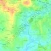
Cintré topographic maps

Click on a map to view its topography, its elevation and its terrain.

La Lande d'Aviette

France > Bretagne > Ille-et-Vilaine > Cintré

Average elevation: 42 m

Gear up for your next adventure:

🔦LED Flashlight - Powerful and long-lasting flashlight for camping and emergencies
🥾Waterproof Hiking Boots - Boots keeping your feet dry in wet conditions
🧤Rechargeable Heated Gloves - Extreme warmth for Canadian winter expeditions
💡LED Camping Lantern - Illuminate your campsite with long-lasting lanterns
🎒Hiking Backpack - Lightweight and ergonomic backpacks for day hikes or multi-day treks

As an Amazon Associate, this site earns from qualifying purchases at no extra cost to you.