Geolocate

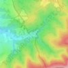
Nová Lhota topographic maps

Click on a map to view its topography, its elevation and its terrain.

Vápenky

Czechia > South Moravian Region > Nová Lhota

Average elevation: 578 m

Gear up for your next adventure:

🧭GPS Tracker - Track your location in remote areas safely
🧢Hiking Sun Hat - Wide-brimmed protection for exposed mountain ridges
🥾Trail Hiking Boots - Supportive boots for rough trails
🗺️Topographic Maps - Detailed maps to explore trails, mountains, and wilderness areas
🧥Ultralight Puffy Jacket - Maximum warmth that packs down to the size of an orange

As an Amazon Associate, this site earns from qualifying purchases at no extra cost to you.