Geolocate

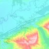
Oued Rhiou District topographic maps

Click on a map to view its topography, its elevation and its terrain.

Oued Rhiou

Algeria > Relizane > Oued Rhiou District

Average elevation: 143 m

Lahlef

Algeria > Relizane > Oued Rhiou District

Average elevation: 255 m

Ouarizane

Algeria > Relizane > Oued Rhiou District

Average elevation: 154 m

Gear up for your next adventure:

☕Camping Coffee Maker - Brew fresh coffee anywhere on the topographic map
🥾Waterproof Hiking Boots - Boots keeping your feet dry in wet conditions
🧢Sun Protection Cap - Breathable cap to protect from sun exposure
🗺️Topographic Maps - Detailed maps to explore trails, mountains, and wilderness areas
🎒Backpack Rain Cover - External shield to keep your entire pack dry

As an Amazon Associate, this site earns from qualifying purchases at no extra cost to you.