Geolocate

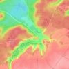
Pierrefonds topographic maps

Click on a map to view its topography, its elevation and its terrain.

Saint-Ladre

France > Hauts-de-France > Oise > Pierrefonds

Average elevation: 112 m

About this place

Gear up for your next adventure:

🚑Survival Whistle - Signal for help across long distances in mountains
🥘Camping Cookware Set - Compact nesting pots and pans for trail cooking
🧴Bear Spray Holster - Quick-access carry for essential Canadian wilderness safety
🛶Waterproof Dry Bags - Keep electronics and clothes dry during river crossings
🔦LED Headlamp - Hands-free lighting for early morning starts or late finishes

As an Amazon Associate, this site earns from qualifying purchases at no extra cost to you.