Geolocate

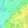
Dry topographic maps

Click on a map to view its topography, its elevation and its terrain.

Clos du Huchet

France > Centre-Val de Loire > Loiret > Dry

Average elevation: 92 m

Gear up for your next adventure:

🥾Trail Hiking Boots - Supportive boots for rough trails
🛰️Satellite Messenger - Emergency communication for areas with no cell service
🏕️Camping Hammock - Integrated protection for sleeping between trees
🗺️Topographic Maps - Detailed maps to explore trails, mountains, and wilderness areas
🧳Compression Sacks - Maximize space in your backpack by shrinking gear

As an Amazon Associate, this site earns from qualifying purchases at no extra cost to you.