Geolocate

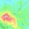
Avrilly topographic maps

Click on a map to view its topography, its elevation and its terrain.

La Dauberie

France > Normandy > Orne > Avrilly

Average elevation: 176 m

Gear up for your next adventure:

🧤Rechargeable Heated Gloves - Extreme warmth for Canadian winter expeditions
🧢Sun Hat - Wide-brim hat for sun protection
🗺️Topographic Maps - Detailed maps to explore trails, mountains, and wilderness areas
🩹Moleskin Blister Pads - Direct protection for painful foot pressure points
🦟Insect Repellent - Keep mosquitoes and black flies away in wooded areas

As an Amazon Associate, this site earns from qualifying purchases at no extra cost to you.