Geolocate

Chapultepec topographic maps

Click on a map to view its topography, its elevation and its terrain.
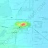
Cerro el Chapulin

Mexico > Chapultepec

Average elevation: 2,582 m

Gear up for your next adventure:

🧦Hiking Liner Socks - Thin base layer to prevent friction and blisters
⛺Backpacking Tent - Lightweight tent for long-distance hiking trips
☕Camping Coffee Maker - Brew fresh coffee anywhere on the topographic map
🚲Handlebar Phone Mount - View topographic-map.com live while cycling
🧢Sun Protection Cap - Breathable cap to protect from sun exposure

As an Amazon Associate, this site earns from qualifying purchases at no extra cost to you.