Geolocate

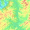
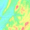
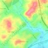
Loudon County topographic maps

Click on a map to view its topography, its elevation and its terrain.

Busselltown

United States > Tennessee > Loudon County

Average elevation: 260 m

Pine Grove

United States > Tennessee > Loudon County

Average elevation: 289 m

Ford

United States > Tennessee > Loudon County

Average elevation: 285 m

Luttrell

United States > Tennessee > Loudon County

Average elevation: 319 m

Bucktown

United States > Tennessee > Loudon County > Lenoir City

Average elevation: 258 m

Tellico Dam

United States > Tennessee > Loudon County

Average elevation: 243 m

Philadelphia

United States > Tennessee > Loudon County

Average elevation: 279 m

Loudon

United States > Tennessee > Loudon County

Average elevation: 267 m

Greenback

United States > Tennessee > Loudon County

Average elevation: 278 m

Lenoir City

United States > Tennessee > Loudon County

Average elevation: 281 m

Eaton Forest

United States > Tennessee > Loudon County

Average elevation: 297 m

Erie

United States > Tennessee > Loudon County

Average elevation: 310 m

About this place

 •

Gear up for your next adventure:

🧢Hiking Hat - Sun-protective and breathable hats for long treks
🧤Rechargeable Heated Gloves - Extreme warmth for Canadian winter expeditions
🧳Compression Sacks - Maximize space in your backpack by shrinking gear
🥫Freeze-Dried Meals - Lightweight, high-calorie nutrition for multi-day treks
🥾Waterproof Hiking Boots - Essential footwear for rugged terrain and wet Canadian trails

As an Amazon Associate, this site earns from qualifying purchases at no extra cost to you.