Geolocate

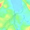
San Rafael topographic maps

Click on a map to view its topography, its elevation and its terrain.

Summit

Philippines > Quezon > Atimonan > San Rafael

Average elevation: 51 m

Gear up for your next adventure:

🧥Ultralight Puffy Jacket - Maximum warmth that packs down to the size of an orange
🧢Outdoor Cap - Protective cap for sun and rain during hikes
🔦LED Flashlight - Powerful and long-lasting flashlight for camping and emergencies
👟Sport Hiking Sandals - Breathable footwear for water crossings and camp rest
🧦Thermal Socks - Warm socks for winter hiking or camping

As an Amazon Associate, this site earns from qualifying purchases at no extra cost to you.