Geolocate

Klima topographic maps

Click on a map to view its topography, its elevation and its terrain.
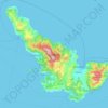
Skopelos

Greece > Thessaly > Sporades Regional Unit > Klima

The second largest settlement is Glossa village, situated on the northwestern tip of the island, just above Loutraki harbour, with an elevation ranging from 200 to 300 m (656 to 984 ft). It is 25.4 km (15.8 mi) from Skopelos town. It is a tranquil village with traditional houses, with 993 residents.

Average elevation: 59 m

Gear up for your next adventure:

💡Portable Camping Lamp - Rechargeable lamp for campsite lighting
🔭Compact Binoculars - Lightweight optics for scouting trails and wildlife
🥾Approach Shoes - Shoes designed for climbing approaches and rugged trails
🧭GPS Tracker - Track your location in remote areas safely
🛰️Satellite Messenger - Emergency communication for areas with no cell service

As an Amazon Associate, this site earns from qualifying purchases at no extra cost to you.