Geolocate

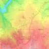
Mutrécy topographic maps

Click on a map to view its topography, its elevation and its terrain.

Les Huets

France > Normandie > Calvados > Mutrécy

Average elevation: 98 m

La Vallée

France > Normandie > Calvados > Mutrécy

Average elevation: 72 m

La Butte

France > Normandie > Calvados > Mutrécy

Average elevation: 70 m

Gear up for your next adventure:

🥾Approach Shoes - Shoes designed for climbing approaches and rugged trails
🥾Trail Running Shoes - Lightweight and durable shoes for trail running
🧣Merino Neck Gaiter - Protects against wind, sun, and cold at high altitudes
🧰Survival Kit - Essential gear for emergencies in the wilderness
🗺️Topographic Maps - Detailed maps to explore trails, mountains, and wilderness areas

As an Amazon Associate, this site earns from qualifying purchases at no extra cost to you.