Geolocate

Cergy topographic maps

Click on a map to view its topography, its elevation and its terrain.
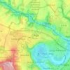
Cergy

France > Val-d'Oise > Cergy > Cergy

Cergy est situé dans le bassin sédimentaire du Vexin français, dans un méandre appelé boucle de l'Oise. Son sous-sol calcaire, riche en tuf a donné lieu au XXe siècle à l'exploitation de gravières. Il est couvert de sables et d'une couche argileuse. Essentiellement ville de plaine, son altitude varie…

Average elevation: 81 m
Chemin de la Côte des Pagnes

France > Val-d'Oise > Cergy > Cergy > Gency

Average elevation: 70 m

About this place

Gear up for your next adventure:

🧥Packable Rain Jacket - Breathable waterproof layer for unpredictable weather
🧤Rechargeable Heated Gloves - Extreme warmth for Canadian winter expeditions
🧰Multitool Knife - Compact and versatile tool for outdoor use
🥤Collapsible Travel Cup - Saves space and weight in your mess kit
🥾Waterproof Hiking Boots - Essential footwear for rugged terrain and wet Canadian trails

As an Amazon Associate, this site earns from qualifying purchases at no extra cost to you.