Geolocate

Talará topographic maps

Click on a map to view its topography, its elevation and its terrain.
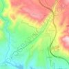
Murchas

España > Andalucía > Partido Judicial de Granada > Lecrín > Talará

En la margen derecha del río Torrente se encuentra esta pequeña localidad 256 habitantes, de ellos 132 varones y 124 mujeres, está situada a 663 metros de altitud. Dista 1 km de Talará y 32 km de Granada.

Average elevation: 689 m

Gear up for your next adventure:

🧥Thermal Fleece Jacket - Versatile insulation for changing mountain temperatures
🕶️Polarized Sunglasses - Protect your eyes with durable polarized lenses
🔭Compact Binoculars - Lightweight optics for scouting trails and wildlife
🏕️Camping Hammock - Integrated protection for sleeping between trees
🥾Light Hiking Boots - Lightweight and comfortable boots for day hikes

As an Amazon Associate, this site earns from qualifying purchases at no extra cost to you.