Geolocate

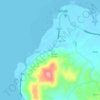
Tugas topographic maps

Click on a map to view its topography, its elevation and its terrain.

Vical

Philippines > Bohol > Tugas

Average elevation: 23 m

Gear up for your next adventure:

🔨Vehicle Emergency Tool - Safety tool for remote road trips to trailheads
🎒Fully Waterproof Backpack - Total protection for photography gear and electronics
🚲MTB Frame Bag - Carry tools and maps directly on your bicycle frame
⛺Bushcraft Tarp - Versatile emergency shelter or gear protection
🛌Insulated Sleeping Pad - Critical thermal barrier between you and the cold ground

As an Amazon Associate, this site earns from qualifying purchases at no extra cost to you.