Geolocate

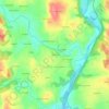
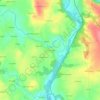
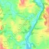
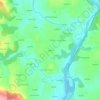
Melrand topographic maps

Click on a map to view its topography, its elevation and its terrain.

Kerduic

France > Bretagne > Morbihan > Melrand

Average elevation: 68 m

Kerprat

France > Bretagne > Morbihan > Melrand > Kerprat

Average elevation: 97 m

Kermouël

France > Bretagne > Morbihan > Melrand

Average elevation: 91 m

Locsamzun

France > Bretagne > Morbihan > Melrand > Locsamzun

Average elevation: 70 m

Kernizan

France > Bretagne > Morbihan > Melrand

Average elevation: 66 m

Lann Georges

France > Bretagne > Morbihan > Melrand > Lann Georges

Average elevation: 68 m

Saint-Rivalain

France > Bretagne > Morbihan > Melrand

Average elevation: 66 m

Kerlay

France > Bretagne > Morbihan > Melrand

Average elevation: 67 m

Kerbroïc

France > Bretagne > Morbihan > Melrand > Kerbroïc

Average elevation: 84 m

Kergair

France > Bretagne > Morbihan > Melrand

Average elevation: 102 m

About this place

 •  •  •

Gear up for your next adventure:

🥾Trekking Poles - Adjustable trekking poles to reduce knee stress and improve stability
🧥Packable Rain Jacket - Breathable waterproof layer for unpredictable weather
🧭GPS Outdoor Watch - Smart watch for navigation and fitness tracking in nature
🧢Hiking Hat - Sun-protective and breathable hats for long treks
🦌Outdoor Trail Camera - Monitor wildlife activity near your favorite spots

As an Amazon Associate, this site earns from qualifying purchases at no extra cost to you.