Geolocate

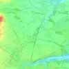
Fontenilles topographic maps

Click on a map to view its topography, its elevation and its terrain.

Labourdayre

France > Occitanie > Haute-Garonne > Fontenilles

Average elevation: 215 m

Couronne

France > Occitanie > Haute-Garonne > Fontenilles > Couronne

Average elevation: 211 m

Bonrepos

France > Occitanie > Haute-Garonne > Fontenilles

Average elevation: 210 m

About this place

Gear up for your next adventure:

🔭Compact Monocular - One-handed bird watching and trail spotting
🥾Trail Running Shoes - Lightweight and durable shoes for trail running
🧰Emergency Multi-Tool - Compact multi-tool for outdoor survival
☕Camping Coffee Maker - Brew fresh coffee anywhere on the topographic map
🌬️Windproof Camp Stove - Efficient cooking even on exposed mountain peaks

As an Amazon Associate, this site earns from qualifying purchases at no extra cost to you.