

Thank you for supporting this site ❤️
Make a donation
Make a donation
Gear up for your next adventure:
As an Amazon Associate, this site earns from qualifying purchases at no extra cost to you.
Belluno topographic maps
Click on a map to view its topography, its elevation and its terrain.


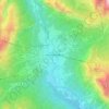
Cortina d'Ampezzo
Italy > Veneto > Belluno > Cortina d'Ampezzo > Cortina d'Ampezzo
Among the surrounding mountains are Tofane to the west, Pomagagnon to the north, Cristallo to the northeast, Faloria and Sorapiss to the east, and Becco di Mezzodì, Croda da Lago and Cinque Torri to the south. Monte Antelao (Nantelou in Ladin) is at 3264 m the highest mountain in the Ampezzo Dolomites and the…
Average elevation: 1,649 m