Geolocate

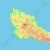
Runello topographic maps

Click on a map to view its topography, its elevation and its terrain.

56360

France > Bretagne > Morbihan > Bangor > Runello

Average elevation: 13 m

Gear up for your next adventure:

🧥Waterproof Pants - Keep dry during rainy hiking conditions
🛰️Satellite Messenger - Emergency communication for areas with no cell service
🧥Thermal Layer - Insulating layer for cold outdoor conditions
👖Convertible Hiking Pants - Zip-off legs to adapt to changing weather conditions
👟Leg Gaiters - Keep debris, mud, and snow out of your boots

As an Amazon Associate, this site earns from qualifying purchases at no extra cost to you.