Geolocate

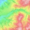
Chandon topographic maps

Click on a map to view its topography, its elevation and its terrain.

La Croix-Leigne

France > Auvergne-Rhône-Alpes > Loire > Chandon

Average elevation: 321 m

42190

France > Auvergne-Rhône-Alpes > Loire > Chandon

Average elevation: 366 m

Gear up for your next adventure:

👟Sport Hiking Sandals - Breathable footwear for water crossings and camp rest
🥾Approach Boots - Comfortable boots for hiking and climbing approaches
🔪Outdoor Multitool - Versatile tool for repairs and food prep in the wild
👟Trail Running Shoes - Agile footwear for fast-paced topographic exploration
🧶550 Survival Paracord - Versatile utility cord for emergency repairs and rigging

As an Amazon Associate, this site earns from qualifying purchases at no extra cost to you.