Geolocate

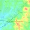
Brandon topographic maps

Click on a map to view its topography, its elevation and its terrain.

Value

United States > Mississippi > Rankin County > Brandon

Average elevation: 125 m

Gear up for your next adventure:

👟Leg Gaiters - Keep debris, mud, and snow out of your boots
🧴Waterproofing Spray - Restore the DWR coating on jackets and tents
🥾Trail Hiking Socks - Comfortable socks to prevent blisters and fatigue
🧢Hiking Sun Hat - Wide-brimmed protection for exposed mountain ridges
⛺Backpacking Tent - Lightweight tent for long-distance hiking trips

As an Amazon Associate, this site earns from qualifying purchases at no extra cost to you.