Geolocate

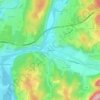
Poncin topographic maps

Click on a map to view its topography, its elevation and its terrain.

Leymiat

France > Auvergne-Rhône-Alpes > Ain > Poncin

Average elevation: 375 m

Menestruel

France > Auvergne-Rhône-Alpes > Ain > Poncin

Average elevation: 351 m

Le Pelan

France > Auvergne-Rhône-Alpes > Ain > Poncin

Average elevation: 323 m

Gear up for your next adventure:

🧤Insulated Winter Gloves - Heavy-duty protection for sub-zero Canadian adventures
🥾Hiking Gaiters - Protect legs and shoes from mud, snow, and debris
🧊Insulated Water Bottle - Keeps drinks cold in summer and prevents freezing in winter
🚲MTB Frame Bag - Carry tools and maps directly on your bicycle frame
🎒Backpack Rain Cover - External shield to keep your entire pack dry

As an Amazon Associate, this site earns from qualifying purchases at no extra cost to you.