Geolocate

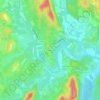
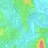
Rauret topographic maps

Click on a map to view its topography, its elevation and its terrain.

Rauret

France > Occitanie > Gard > Orthoux-Sérignac-Quilhan > Rauret

Average elevation: 79 m

30260

France > Occitanie > Gard > Orthoux-Sérignac-Quilhan > Rauret

Average elevation: 74 m

Gear up for your next adventure:

🧢Outdoor Cap - Protective cap for sun and rain during hikes
🌬️Windproof Camp Stove - Efficient cooking even on exposed mountain peaks
🧢Hiking Hat - Sun-protective and breathable hats for long treks
🧰Emergency Multi-Tool - Compact multi-tool for outdoor survival
🧥Thermal Layer - Insulating layer for cold outdoor conditions

As an Amazon Associate, this site earns from qualifying purchases at no extra cost to you.